Monitoring networks
Three monitoring networks operate in the SMAPEx study area during these intensive field experiments:
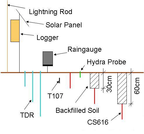
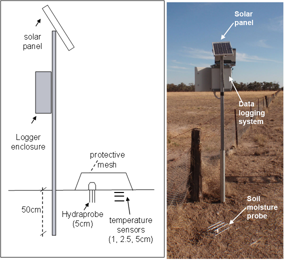
- OzNet network of permanent sites (2003-present), measuring profile soil moisture and temperatures;
- SMAPEx network of semi-permanent sites (2010-present), measuring surface soil moisture and temperatures;
- Supplementary network of temporary sites (4-8 December 2010), measuring profile soil temperature and soil moisture, thermal infrared, leaf wetness and rainfall.
Data from the OzNet and SMAPEx networks are available on the OzNet website.
SMAPEx and OzNet networks
Monitoring networks
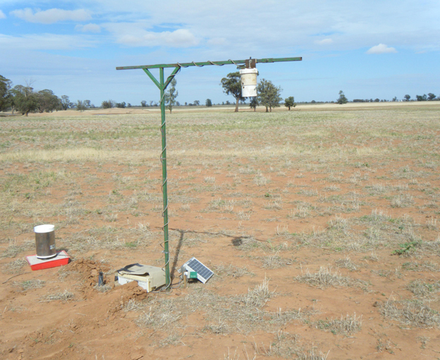
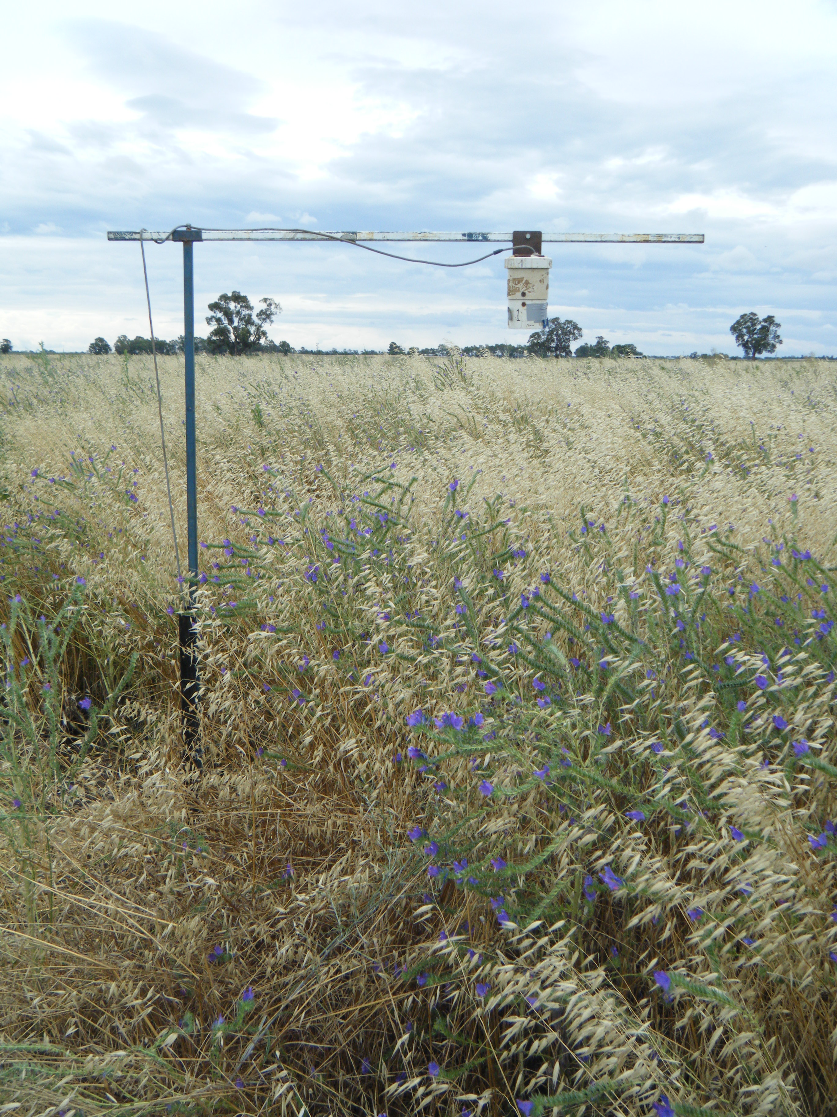
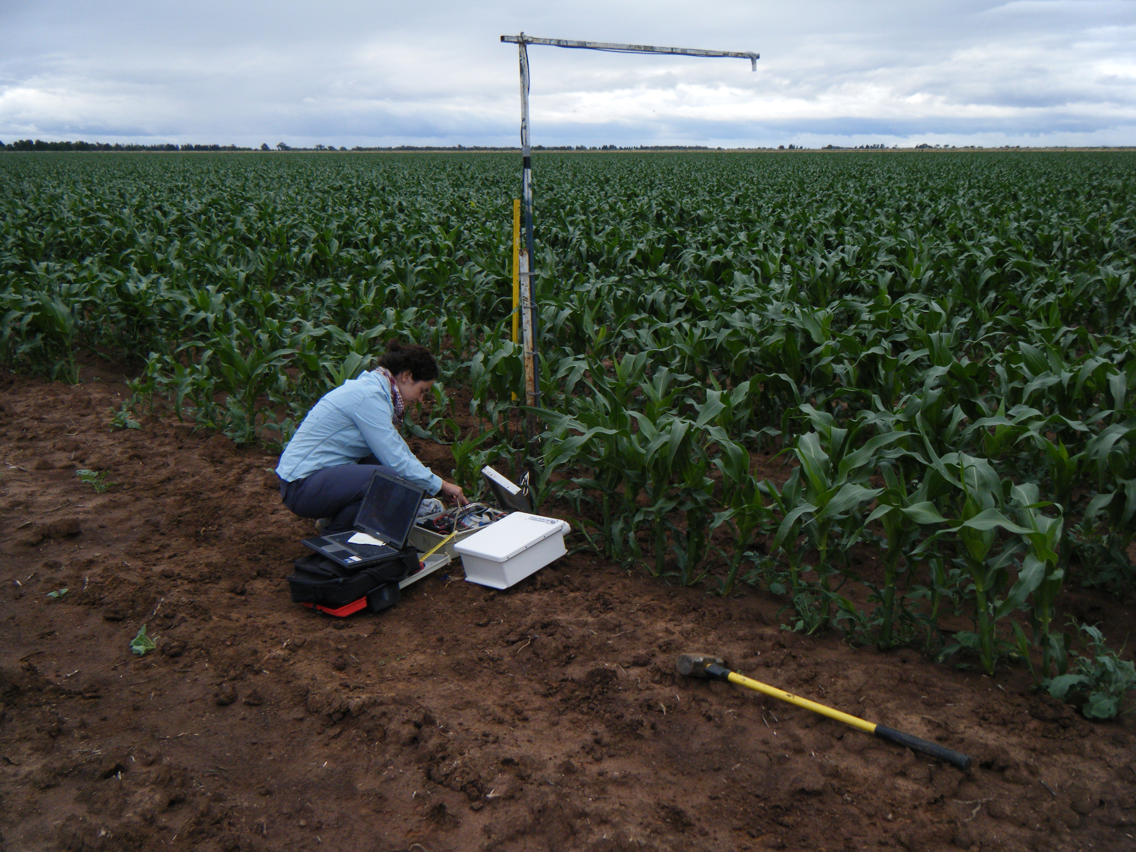
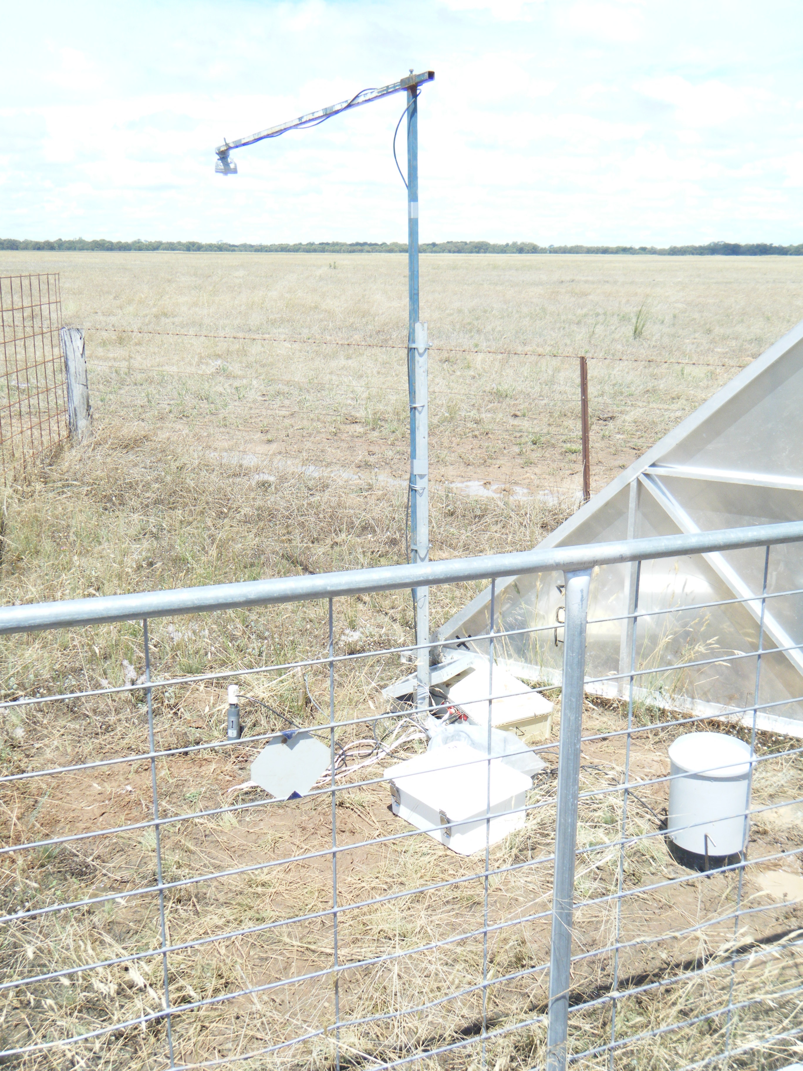
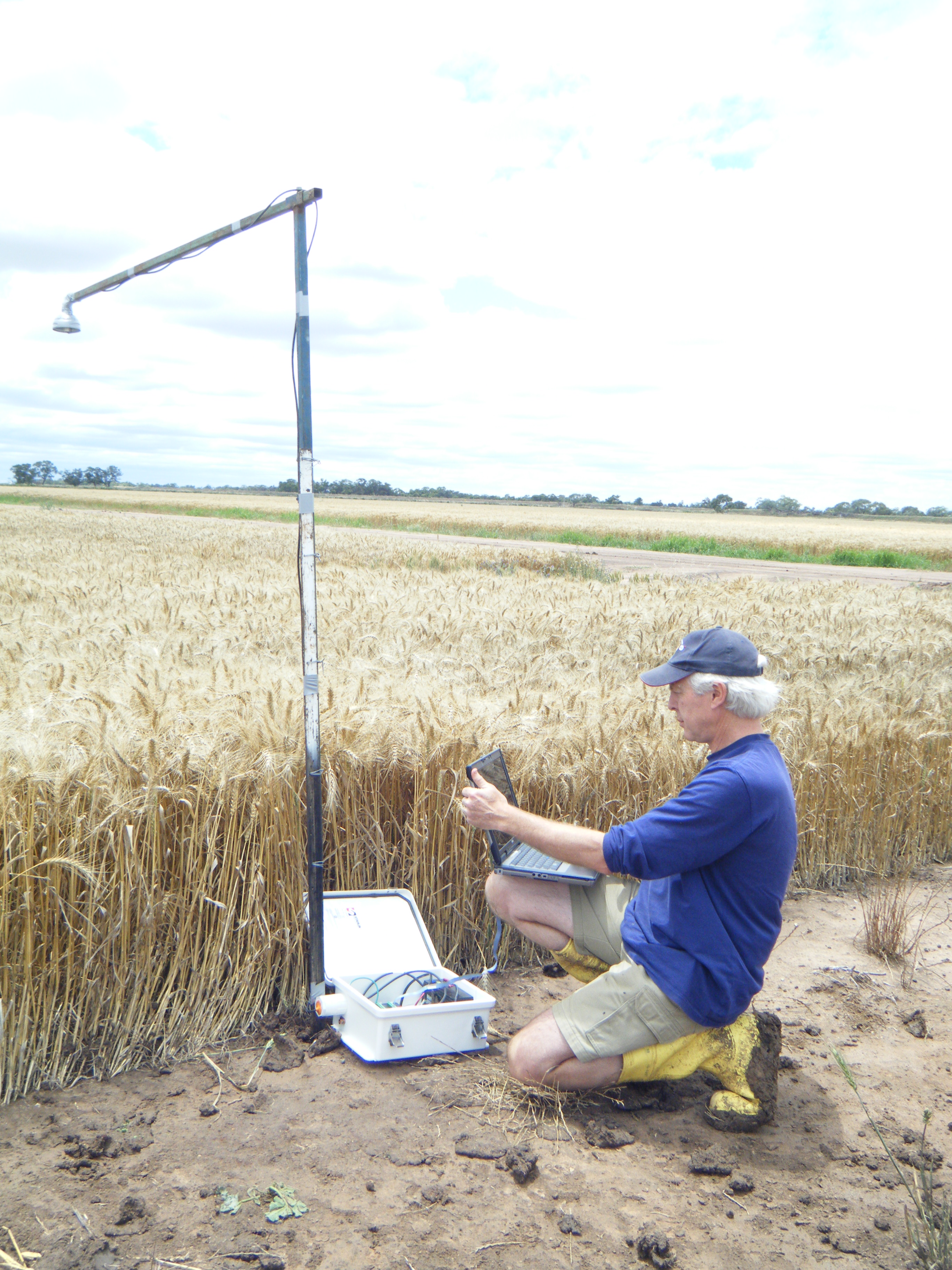
Supplementary network
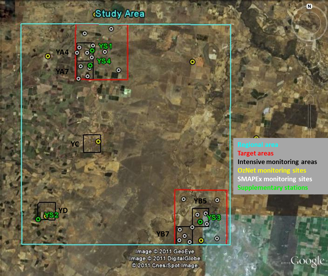
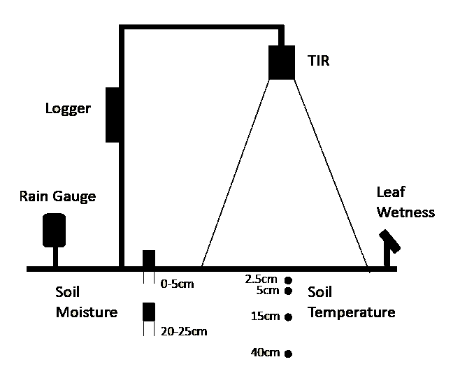
In addition to the available permanent soil moisture monitoring network provided by OzNet and the semi-permament network installed for the SMAPEx project, supplementary temporary monitoring stations have been installed during the SMAPEx campaign. The supplementary stations were distributed across the study area to monitor vegetation and soil temperature in representative areas on the basis of dominant vegetation types. During December 2010, the area was mostly occupied by wheat, maize, grass and pasture. Supplementary station data can be downloaded from Download Centre.
Locations of supplementary monitoring stationsThese short-term monitoring stations have been instrumented with a raingauge, thermal infrared sensor (Thermalert Tx or Apogee SI-121), leaf wetness sensor (MEA LWS v1.1), two soil moisture sensors (Delta-T Thetaprobes; 0-5cm and 20-25cm) and four soil temperature sensors (MEA6507A; 2.5cm, 5cm, 15cm and 40cm depth) in order to provide time series data during the sampling period.
Supplementary station Data status
-20~25cm soil moisture data unreliable
-See readme file29/11-8/12
1/12-8/12 (Apogee TIR)-See readme file
4/12-11/12 (Apogee TIR)-No 20~25cm soil moisture data due to probe malfunction
-See readme file
1/12-8/12 (Apogee TIR)